Severe Storms Possible in Tuscaloosa, Alabama Today: What You Need to Know
A cold front is expected to move across the state today and severe storms are anticipated ahead of cooler temperatures.
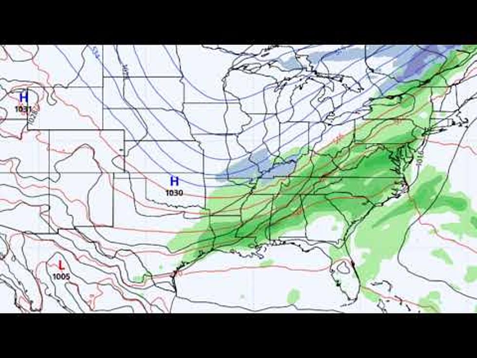
The latest forecast from the National Weather Service in Birmingham projects storms to impact West Alabama between 9 a.m. and 1 p.m. today.
Damaging winds of up to 60 miles an hour and quarter-size hail will be possible. ABC 33/40 Chief Meteorologist James Spann explains threats associated with today's storms in the latest post on alabamawx.com:
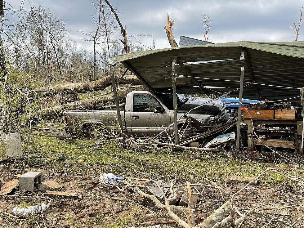
The main threat today will come from strong, potentially damaging straight line winds. With the ground saturated, it won’t take much to knock down some trees. An isolated, brief tornado is possible, but not likely. Some small hail is a possibility as well.
Temperatures in Tuscaloosa will drop rapidly after storms with highs falling into the 40's. A freeze will be possible overnight.
Townsquare Media Tuscaloosa's Operation Storm Watch is brought to you by Safe-T Shelter. Visit their website here to see their selection of residential and commercial safe rooms and storm shelters. To contact a Safe-T Shelter representative, click here to visit their Facebook page.

Check out the latest radar models here:
If a tornado warning is issued in our area, Townsquare Media Tuscaloosa Operation Storm Watch will provide you with live and local team coverage, including wall-to-wall weather with James Spann.
To view the latest weather updates and information, click here.
TIPS: Here’s how you can prepare for power outages
KEEP READING: What to do after a tornado strikes
KEEP READING: Get answers to 51 of the most frequently asked weather questions...
More From Praise 93.3