Be Prepared for Severe Weather Over the Next Few Days in Alabama
As we are counting down the days to 2022, we will need to be on guard for the possibility of severe weather in Central Alabama later today, tonight, and early Thursday morning. Also, it’s best to stay weather aware for the next several days as well.
Townsquare Media Coverage Areas
Bibb
Fayette
Greene
Hale
Lamar
Perry
Pickens
Sumter
Tuscaloosa
Walker
During severe weather scenarios, Townsquare Media radio stations will bring you updates for all types of severe weather. Also, we will host wall-to-wall cover during a Tornado Warning to give you the information you need to keep safe and informed.
Townsquare Media Radio Stations
Praise 93.3, 92.9 WTUG, 95.3 The Bear, Nick 97.5, Catfish 100.1, Tide, 100.9, ALT 101.7, and 105.1 The Block.

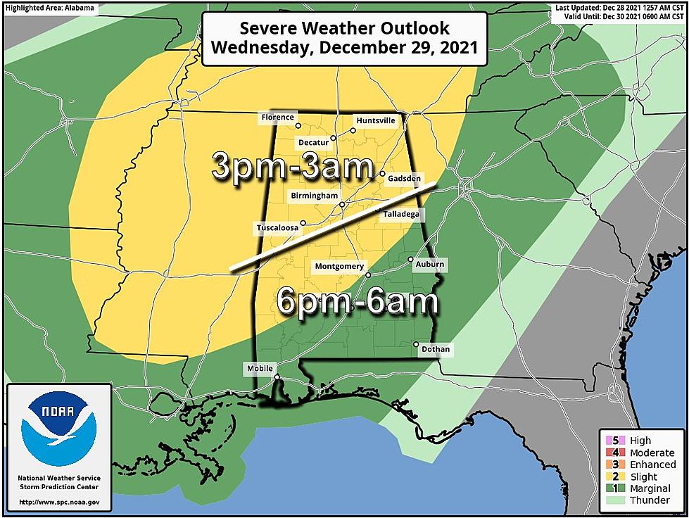
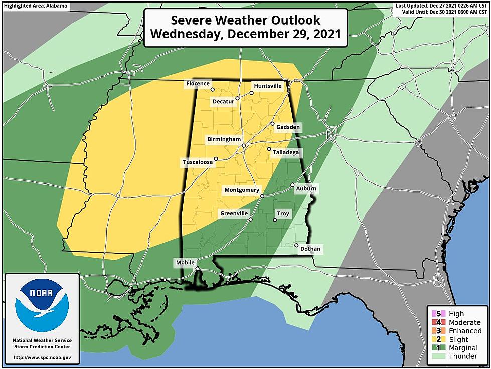
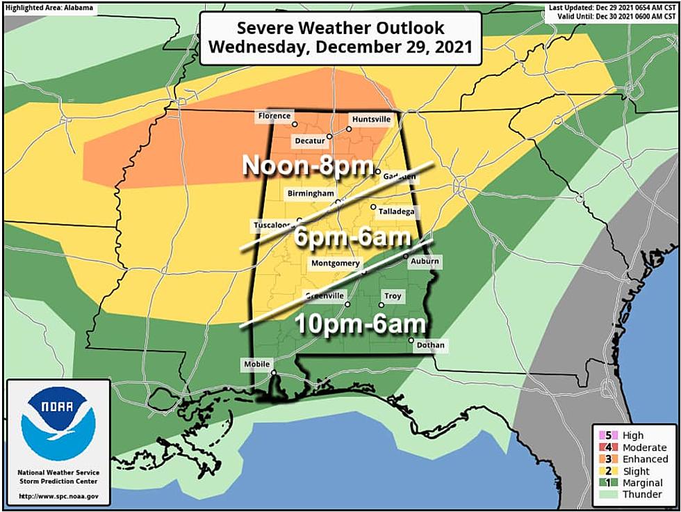
Severe Weather Outlook Wednesday into Thursday
Update from National Weather Service Birmingham at 10 am. There is now an "enhanced threat area added for the northwest counties."
James Spann, ABC 33/40, and Townsquare Media Tuscaloosa Chief Meteorologist said that “thunderstorms across Alabama this afternoon and tonight could be strong to severe.” The Storm Prediction Center (SPC) “has issued an "enhanced" risk (level 3/5) for North Alabama (including places like Florence, Huntsville, Cullman, and Hamilton). There is a "slight risk" (level 2/5) as far south as Grove Hill, Prattville, and Lafayette. And, the southern half of the state is in a "marginal risk" (level 1/5).”
Threats
Damaging winds up to 60-70 mph (updated at 10 am)
Tornadoes are possible.
Timeline
Spann mentioned that “storms with this event will be rather random and scattered, so there is no way of producing an ETA for a specific spot. The broad window for severe storms will come from 12 Noon to 8 pm for areas north of I-59, 6 pm to 6 am for the central part of the state, and from 10 pm to 6 am for South Alabama.”
Developing Weather Scenarios
Friday, New Year’s Eve Severe Weather Outlook
There is a level 1 out of 5 with a “marginal risk.” Spann noted that this is “north of a line from Reform to Birmingham to Heflin. Storms there Friday afternoon could produce strong gusty winds; tornadoes, for now, are not expected.”
Information for Saturday, New Year’s Day
We are monitoring this weather situation for the potential for severe weather. As of right now, the timeline will be Saturday night into Sunday morning ahead of a cold front. The risk includes most of Alabama. Spann said that “for now it looks like the main threat will come from strong straight-line winds; forecast wind fields are rather unidirectional, which will limit any tornado threat.”
Sunday Weather Outlook
Be prepared for much colder temperatures around the 30s and 40s depending on your location in the state. Spann mentioned that there could be “few scattered light snow flurries, but most places won't see a flake. Temperatures will be in the 20s by Monday morning.”
(Source) Click here to follow the Facebook Page for James Spann. Click here for more from the National Weather Service Birmingham.
You Might Be Shocked by the Price Tag this Georgia Estate
This Madison, Alabama Mansion is a True Lap in Luxury
The Most Expensive Home for Sale is in Muscle Shoals, Alabama
Peek Inside This Eccentric Downtown Tuscaloosa, Alabama Condo
Daphne, Alabama Luxurious Beverly Hills Styled Mansion For Sale
Rare Monolithic Dome Home Can Be Found in New Hope, Alabama
Look at This Tricked Out Alabama Lake Martin Mansion Airbnb
More From Praise 93.3