Potential Severe Weather in Northwest Alabama Tonight, Tomorrow
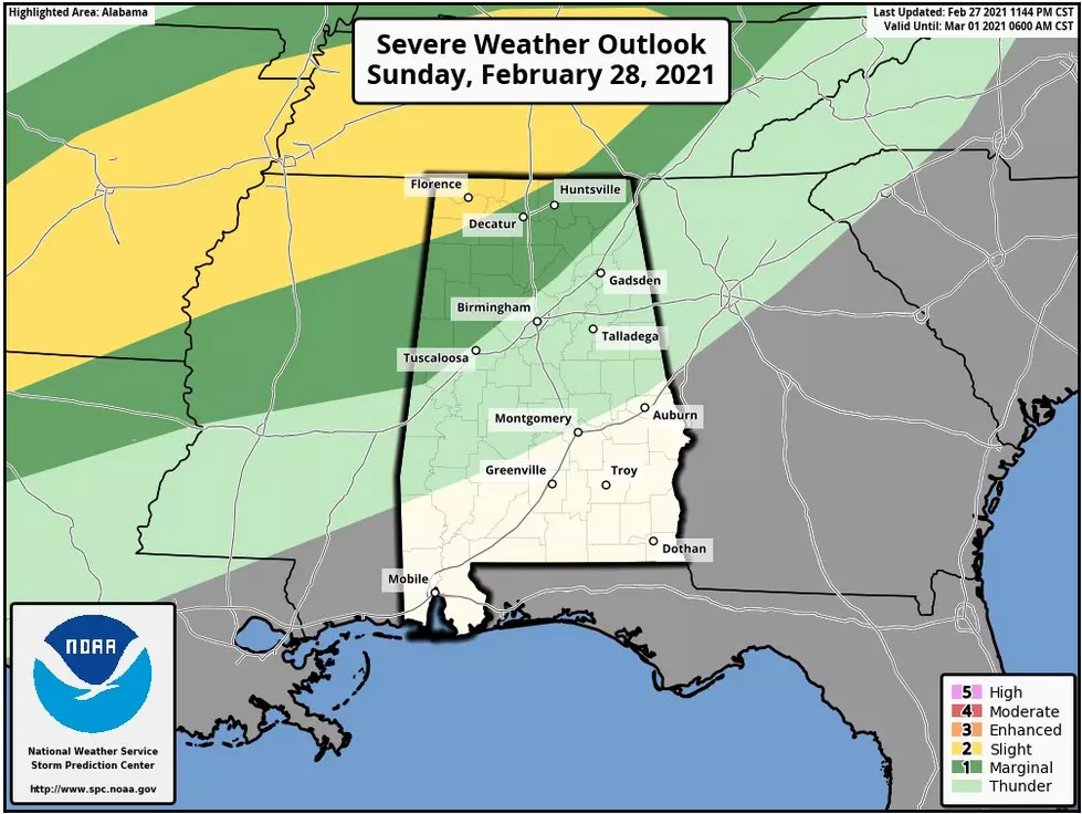
The Storm Prediction Center has issued a severe weather risk for the northwestern sections of Alabama. The Alabama WX Weather Blog notes that "this line is roughly along and northwest of a line from Aliceville in Pickens County to Jasper to Cullman to Scottsboro."
The National Weather Service in Birmingham gives us insight on the timeline that "isolated severe thunderstorms will be possible across our northwest counties in Central Alabama generally from 10 pm tonight through 6 am Monday morning. A brief tornado and damaging winds to 60 mph will be the main threats."
James Spann, ABC 33/40, and Townsquare Media Tuscaloosa Chief Meteorologist explained further that "a few strong to severe thunderstorms are possible along the front over the northwest corner of Alabama, where a "slight risk" (level 2/5) has been defined by SPC. A "marginal risk" (level 1/5) extends as far south as Northport, Warrior, Boaz, and Mentone. Thunderstorms tonight over Northwest Alabama could produce hail and strong gusty winds; an isolated tornado can't be ruled out... although the higher tornado probabilities are over West Tennessee."
Don't forget that the heavy rains associated with this system could cause minor flooding in our northwest counties of Central Alabama. Click here for the information on the Flooding watches. As always, remember this perfect phrase. Turn around. Don't drown.

(Source) Click here for more from the Storm Prediction Center. Click here for more from the Alabama WX Weather Blog. Click here to follow the Facebook Page for James Spann. Click here for more information from the National Weather Service Birmingham.
LOOK: Here are the best small towns to live in across America
More From Praise 93.3