Preparing You for a Late Night Severe Weather Threat in West, Central Alabama
The South, Midwest, and the Plains are preparing for the possibility of severe weather over the next few days. Here in West and Central Alabama, we are focused on Wednesday evening April 13, 2022, into Thursday morning April 14, 2022.
The main concern is that this weather event is that it is a late evening situation where many Alabamians might be asleep. Please be sure to check that your “do not disturb feature” is turned off and please do not silence your phones when going to bed on Wednesday. Stay weather aware.

The National Weather Service in Birmingham has provided us with an overview of what they currently expect from the storm system.
When:
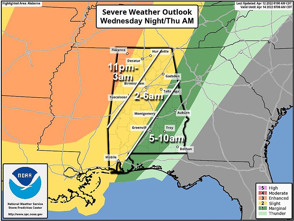
Wednesday night through Thursday morning, possibly lasting as late as 10 am Thursday along and south of the I-85 corridor.
Threats:
Tornadoes
Damaging winds up to 60 mph with some potential for 70 mph winds in the enhanced risk area
Quarter-size hail
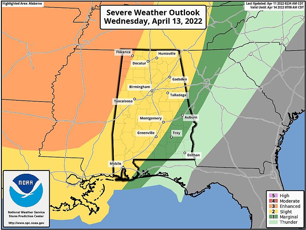
We are monitoring this system and watching for any changes in forecasting as a cold front will push through our area. The Storm Prediction Center has defined the following risk levels and areas.
"Enhanced Risk"
This is a level 3 out of 5 for the northwest corner of the state
"Slight Risk"
This is a level 2 out 5 for North, Central, and Southwest Alabama
"Marginal Risk"
This is a level 1 out of 5 for portions of Southeast Alabama

Insight on Timing
James Spann, ABC 33/40, and Townsquare Media Tuscaloosa Chief Meteorologist said that the “line should enter the northwest corner of the state late tomorrow night around 11:00 p.m.. it will reach I-59 (Tuscaloosa/Birmingham/Gadsden) around 4-5 a.m... and then moving into East and Southeast Alabama after 6:00 a.m. The storms should weaken after 3:00 a.m. as instability decreases and dynamic support fades.”
Possible Threats
“The main threat will come from strong, gusty winds ahead of the line, but an isolated tornado can't be totally ruled out, especially over the northwest counties of the state,” said Spann.
Flooding Potential
We will also monitor the potential for any flooding issues. The Weather Channel commented that “given the recent rounds of severe weather across the South and Ohio Valley, there is at least some threat of flash flooding where heavy rain occurs.”
(Source) Click here to follow the Facebook Page for James Spann. For more from the National Weather Service Birmingham, click here. To find out more from The Weather Channel click here.
Top Stories from the Tuscaloosa Thread (4/4 - 4/11)
KEEP READING: Ordinary People, Extraordinary Stories
Tuscaloosa Restaurants and Stores That Closed for Good in 2021
More From Praise 93.3