BIG Temperature Drop Later Today
Weather Update for Thursday, October 31, 2019
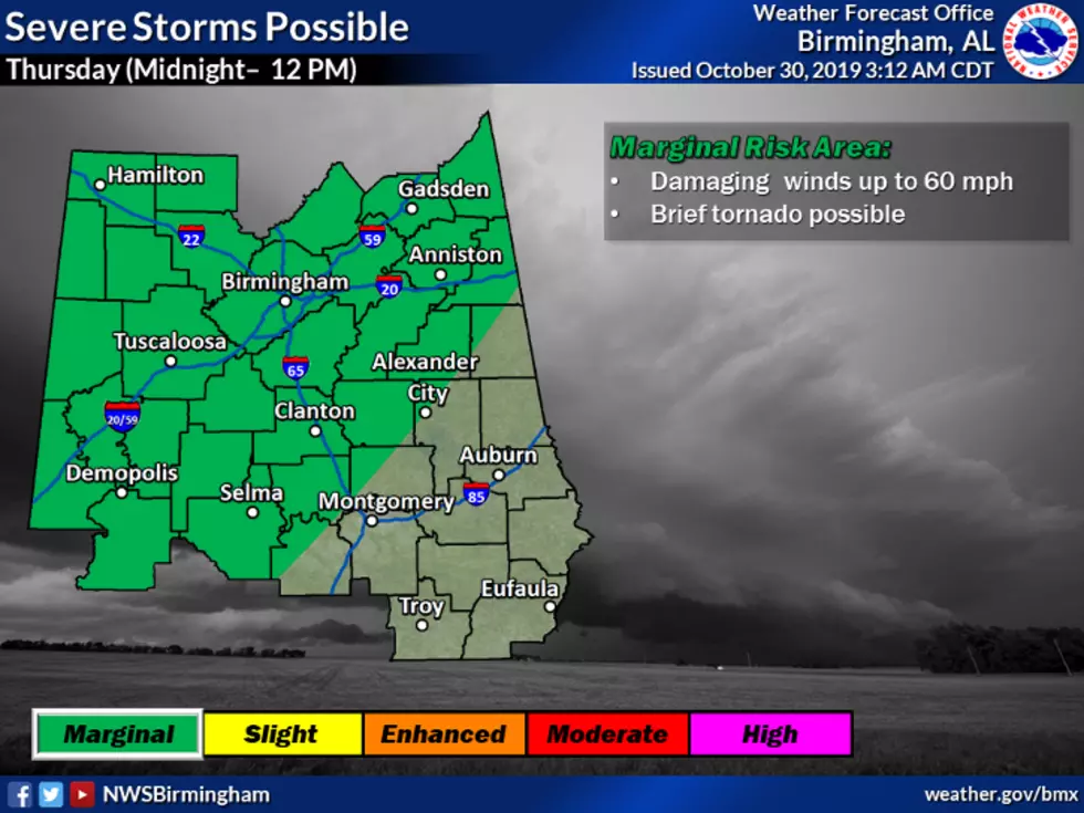
Today we start off with a 100% chance of showers and thunderstorms with a high near 62. As the day progresses, the rain and thunderstorm chance drops to 40%. We still have the potential for severe weather today, most of our listening area is under a slight risk, and the eastern counties are listed under a marginal risk. Please be mindful that wind gusts can get as high as 25 mph.
Please be prepared for the BIG temperature drop in the early evening (around 5 pm) to 47 degrees for some areas.
Weather Heads Up: The National Weather Service has issued a hazardous weather outlook for tonight because temperatures are expected to fall to near or just below freezing for the northern areas of Central Alabama Friday morning.�� Temperatures may drop to near or just below freezing for the northern areas of Central Alabama Saturday and Sunday mornings. This outlook is for the following counties: Marion-Lamar-Fayette-Winston-Walker-Blount-Etowah-Calhoun-Cherokee-Cleburne-Pickens-Tuscaloosa-Jefferson-Shelby-St. Clair-Talladega-Clay-Randolph-Sumter-Greene-Hale-Perry-Bibb-Chilton-Coosa-Tallapoosa-Chambers-Marengo-Dallas-Autauga-Lowndes-Elmore-Montgomery-Macon-Bullock-Lee-Russell-Pike-Barbour.
Be sure to follow me on Twitter at @MaryKRadio
More From Praise 93.3