Severe Storms Likely Thursday
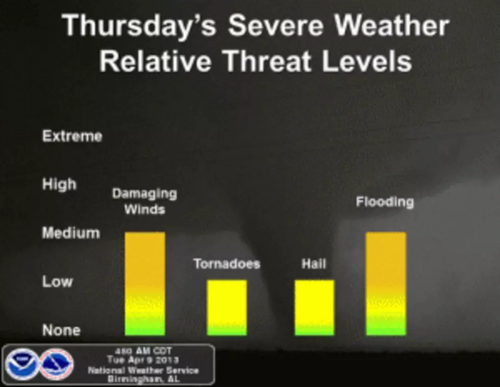
Thursday's forecast calls for severe thunderstorms that could potentially bring damaging winds, hail, and isolated tornadoes to Alabama. For Tuscaloosa, Thursday's forecast is showers and thunderstorms which could produce gusty winds and damaging rain with a 90% chance of precipitation. The following forecasts from the National Weather Center outline when the storms are expected to impact our area.
The National Weather Service's Storm Prediction Center's SPC Outlook for Thursday shows a 30% chance of severe storms for areas to the southeast of Birmingham; however, the entire state is still at risk for severe weather.
ABC 33/40 Chief Meteorologist James Spann describes tomorrow's forecast on his weather blog: "The primary window for severe weather in Alabama will come from 9:00 a.m. until 9:00 p.m. Thursday. We could see a few storms before 9:00 a.m. but the main severe weather comes later. Projected shear profiles are not impressive; this will greatly limit the tornado threat. While the chance of a tornado is not zero, we believe tornadoes will be very isolated in nature. Forecast soundings look pretty unidirectional, and bulk shear values in the lower levels are fairly low for an event like this. [...] Just a reminder… please take severe thunderstorm warnings seriously Thursday; damaging straight line winds can produce damage just like a tornado in some cases."
Take James Spann's advice and pay attention to any watches or warnings issued Thursday. Now is a good time to go over your severe weather plan with your family. I always make sure my flashlight and portable radio have batteries. I also make sure that our cell phones stay fully charged in advance of the storm system. You never know when you'll need to make a phone call!
More From Praise 93.3